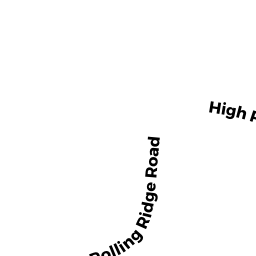
11 ROLLING RIDGE RD
Owner Information
MESHNICK HOWARD R
11 ROLLING RIDGE RD
ANDOVER, MA 01810


Property Details
11 ROLLING RIDGE RD is classified as a Single Family Residential (Colonial).
The primary structure on this property was built in 1957. There are 3,216ft2 of built area within this property. There is 3,216ft2 of residential/living space within this property. This property is listed as having 8 rooms.
11 ROLLING RIDGE RD is valued at $751,700. The land is valued at $394,400 and the structures are valued at $357,300.
This property is in Zone SRB. Confirm with local Zoning Board authorities to ensure there are no overlays or other easements on this property.
11 ROLLING RIDGE RD was last sold on Friday, February 26, 1993 for $265,950.
Assessment data from fiscal year 2021.
Flood Data
According to the FEMA National Flood Hazard Layer, this property does not appear to be in a flood zone. It may also be in an area not yet reviewed. Nonetheless, confirm this information prior to taking any action.
To view the flood hazards around this property, create a FEMA "Firmette" Map of the area around 11 ROLLING RIDGE RD.
Broadband Internet Providers
| Provider | Type | Bandwidth (mbps) | |
|---|---|---|---|
| Verizon New England Inc. | Fiber | 940 | 880 |
| Verizon New England Inc. | DSL | 10 | 1 |
| Viasat Inc | Satellite | 100 | 3 |
| GCI Communication Corp. | Satellite | 0 | 0 |
| HughesNet | Satellite | 25 | 3 |
| VSAT Systems, LLC. | Satellite | 2 | 1 |
| Crown Castle Fiber | Fiber | 0 | 0 |
| Comcast | Cable | 1000 | 35 |
Broadband service provider data from December 2020.
Adjacent Properties
- 120 HIGH PLAIN RD
Single Family Residential owned by HAGGERTY MARJORIE E - 112 HIGH PLAIN RD
Single Family Residential owned by BUCKLEY MATTHEW F - 108 HIGH PLAIN RD
Single Family Residential owned by MCGINN MARYBETH J - 5 ROLLING RIDGE RD
Single Family Residential owned by CURTIN FAMILY TRUST - 17 ROLLING RIDGE RD
Single Family Residential owned by BROWN MARK IAN